Amazing Mount Lemmon Trek
- uniquejt
- Feb 17, 2023
- 2 min read

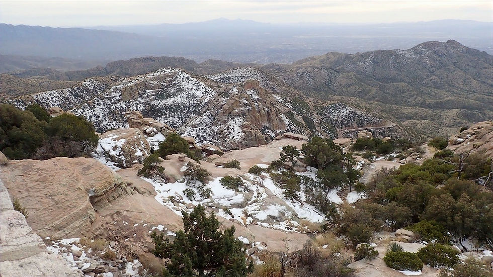
Friday afternoon, February 17 we embarked on a trek up Mount Lemmon, with a summit elevation of 9,159 feet, the highest point in the Santa Catalina Mountains. It is located in the Coronado National Forest just north of Tucson, Arizona. We drove the Catalina Highway, also called the Mount Lemmon Highway, up the Santa Catalina Mountains 26 miles from the east side of Tucson up to the town of Summerhaven, at the top of Mt. Lemmon. The beautiful, curving road is a favorite drive for tourists, for locals escaping summer's heat and cyclists, and has been recently designated as the Sky Island Parkway, part of the US National Scenic Byway system.
The road meanders up the mountain with countless breathtaking views along the way. Mount Lemmon’s peak can be 20-30 degrees cooler than the town of Tucson below. You’ll traverse through 6 different ecosystems, starting in saguaro dominated desert and ending up at evergreen forests, as you meander up the scenic mountain traverse.
Sabrina, our hostess from QYB Ranch told us that once we arrived in the small town of Summerhaven, we should stop at the General Store and get some fresh fudge they make for the tourists. And yeah, we did and it was delicious!


Few people think of snow and skiing when they think of Tucson. Cacti, desert, and diamondback snakes more readily come to mind. The Santa Catalina Ranger District, however, is home to the southernmost ski area in the continental United States, which is perched near the 9,157-foot summit of Mt. Lemmon. Ski runs are usually open from mid-December to early April, depending on winter weather and snowfall. Located just an hour’s drive from the sun-drenched resorts of Tucson, area visitors can golf and swim in Tucson, then downhill ski at Ski Valley, all in the same day. Mt. Lemmon Ski Valley offers ski equipment rentals, instruction, the Iron Door Restaurant, a snack bar, and gift shop.


Comments