Search Results
337 results found with an empty search
- Departing Texas for Colorado
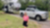
Our trip to the Caribbean with the kids was a great way to get re-energized. Now back in Smithville, it is time to get ready to leave Texas for an extended period on the road. Our first tasks to accomplish include a number of medical appointment for the two of us. A check up here and there to make sure we are good to go in the physical department. With that out of the way, we said our good-byes to the villagers and departed Smithville. This year-round, family friendly campground accommodates both tents and RVs and has many amenities, such as a playground, restrooms with sinks, flush toilets, and showers, and an activity center. Our first destination is Live Oak Ridge campground located at Belton Lake close by the dam and the city of Belton. Belton Lake was created by the U.S. Army Corps of Engineers with the construction of Belton Dam in 1954. The 12,300-acre lake is located on the Leon River, just upstream of the confluence of the Leon River and the Little River. Belton Lake is a long, narrow and winding lake with many curves and coves, providing some of the best camping, fishing, and boating in Central Texas. We stayed here two nights and met Al and Marilyn Tumazi, a couple we met on the last cruise who live in the area, for dinner on Friday, April 10. We had a fun visit and dinner together at Luigi's Italian restaurant. What a blessing to make new friends wherever we go. Saturday I was scheduled to assist another Coast Guard Auxiliarist in teaching a Texas boating safety class, but it got got cancelled due to lack of registration. So I met up with Mark Prentice from Flotilla 081-05-07 at his home to talk and get to know one another. Mark is a retired USCG Chief Warrent Officer and has a wealth of knowledge about all topics associated with the Auxiliary in Texas. He will be a valuable resource for me in the future. With the weather expected to deteriorate substantually in the area we packed up in the rain Sunday morning and headed northwest towards our next stop. It would be a long day of driving, about 6 hours to Levelland, Texas in the panhandle. We stopped twice for fuel because of some severe headwinds but eventually arrived at this gem of a stop. One of Levelland's special use parks, this park is reserved for Recreational Vehicles (RVs). The RV Park is located south of Levelland on Highway 385, adjacent to Levelland Municipal Airport and includes seven paved spots with access to water and electricity. The park is for short-term visitors to Levelland to use without cost! Camper spaces are provided free of charge on a first come, first serve basis. This is my review on RV Life, "The city of Levelland's RV campground was level (no joke intended), had water and electric at each site with a dump station available. Be advised, it can get windy here, so we parked our door on the leeward side of our space. There were two large dumpsters for trash. The site is just off the highway into town, so you might experience some road noise. We didn't notice it as a problem. If you're heading either north or south and don't want to drive through Amarillo, Highway 36 is a relaxing drive and you can get everything you need in the smaller towns along the way. Just can't beat the price and the accommodations! We camped at Levelland RV Park in a Fifth Wheel." We drove through Levelland the next morning and that town has everything you might need for the continuing journey. We didn't need to stop so we pressed on for another five hours with a few more fuel stops until we reached Raton Pass Camp & Café, conveniently located off Interstate 25 at the top of Raton Pass between Trinidad, Colorado and Raton, New Mexico. Easy access from either the northbound or southbound lanes is accessed using Exit 460. Crossing into New Mexico we gained a hour entering the Mountain Time Zone. With the rain behind us and traveling downgrade, we hoped to make better fuel mileage than 200 miles on a tank. Diesel was running at between $4.85 and $5.39 a gallon on this leg. Fortunately we are almost to the final destination we booked for a week which was not far from our son, Erik's family, in the Denver, Colorado suburbs.. Located in the Denver metro area and open year-round, Cherry Creek State Park offers visitors a unique chance to enjoy the surrounding prairie with a camping getaway. It has 128 camping sites located on multiple loops at 5,657 feet above sea level. Cherry Creek State Park is a 4,200-acre recreation haven in the Denver metro area for boaters, anglers, campers, bicyclists, equestrians, swimmers, hikers and picnickers alike. Anchored around an 880 surface-acre reservoir, the park offers a natural prairie landscape of gentle, rolling hills and complete outdoor recreation amenities, including camping, picnicking and facilities for group events. They have a saying here in Colorado, "If you don't like the weather, just wait an hour!" On Tuesday, April 14, we arrived at our pull-thru site #149 o n the Buffalo Loop with plenty of room for our fifth-wheel and the detached truck. This was our base for the next week until Tuesday, April 21. From here we would drive about 35 to 45 minutes to visit Erik, Tori and the grandkids at their home in Thornton. We arrived just in time to help out before Tori left for a trip to Paris, France with her mother and other relatives. Erik really appreciated the help with dinners in the evenings and driving to practices and games the kids have after school and on the weekends. The weather was crazy with 3 inches of snow on Friday, April 17, the very day that Tori was flying out. It worked out for the good because all the practices got cancelled. On Saturday there was still too much snow on the ground so soccer and baseball practices got cancelled. Erik, Mattis and I went to see the Dodgers play the Rockies at Coors Field, Karen, Emery and Arley went to the movies. Sunday, Karen and I took the boys to church and later met Erik and Emery at her soccer match at noon. Monday was our last full day visiting the area. We got to see Mattis play on his baseball team that evening. It was a wonderful, action packed week filled with quality time with our son and grandkids!
- Cruising with the Tayler Crew
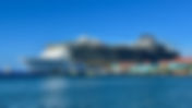
We got back from our second RVICS project on Thursday to pack for our upcoming cruise departing on Sunday. Our son Nick and granddaughters, Morgan and Grace were arriving from Sacramento on Saturday night for this week-long Royal Caribbean cruise out of Galveston. Our destinations included two days at sea before our first port of call in Roatan, Honduras, on to Costa Maya and Cozumel, Mexico before returning to Galveston. Our ship was the Allure of the Sea , a 225,282-gross-ton, Oasis-class cruise ship operated by Royal Caribbean International, accommodating over 6,300 passengers, one of the largest ships in their fleet. She has 17 decks and offers extensive, varied entertainment. Features include a variety of theme Restaurants, Broadway shows, ice skating, and dedicated, themed neighborhoods. Previous reviews often praise the diverse entertainment options, specifically the Broadway-style shows and the unique Central Park area with live plants. We boarded the ship at 1:30 Sunday afternoon and went immediately to our cabins. Karen and I had a balcony cabin on the starboard side of the ship on deck 7. Nick and the girls had their balcony cabin on deck 6 port side. Since our first two days would be at sea, it gave us plenty of time to relax and explore the ship. Karen and I would enjoy a quiet breakfast in the American Icon dining room while Nick and the girl slept in. Karen liked going to the gym and I preferred walking the track around deck 5. At dinner we choose to enjoy the less crowded and more formal seating arrangement at our designated table 701 for the five of us in the dining room called Silk on deck 5. Here we were served by our waiter John and assistant waiter Marvin for the entire week. All our meals were three courses; starter, main and dessert. Morgan loved the cheese rolls served at every meal and I think Grace had a Caesar Salad every night. The dining room food was hot, delicious and served quickly. It is a definite dining improvement over the crazy atmosphere of the Windjammer buffet on deck 16. There was plenty to occupy the time at sea with multiple pools, water slides, Flow Rider wave pool, climbing walls and a 6 story dry slide called the Ultimate Abyss at the stern of the ship. This is the entrance to the Ultimate Abyss slide. You sat on a rug sleeve and rode it down the tunnel in the dark. Karen screamed the whole way down. The slide ended at deck 6 where there was a sports bar, carousel and hot dog eatery. At the back was the outdoor theater for the water show. Royal Caribbean's AquaTheater shows are high-octane, complimentary performances featured on Oasis and Icon-class ships, combining Olympic-level diving, aerial acrobatics, slacklining, and synchronized swimming. Performed in a specialized rear-facing amphitheater for the Icon-class AquaDome. There was an ice rink on deck 8 where we saw a wonderful ice show. And the main theater at the bow of the ship had musical revues and the broadway show Mama Mia performed on the last two nights of the cruise. When not at sea we enjoyed our three ports of call. First was Roatan where we did a shore excursion that included a zip line course, snorkeling on the reef and lunch. The zip line experience was great, the snorkeling not so much, the lunch mediocre. But we all had a great time.. I discovered that I must have encountered some mosquitoes or jellyfish because I came back to the ship with multiple bites on my legs and ankles. Day 4 was Costa Maya after Roatan. We got off the ship to explore the port. This is where we couldn't land on our last cruise with Bob and Gail Conrad before Christmas last year due to the windy conditions. Well, we didn't miss much. The port is just a tourist trap where the locals sell their overpriced souvenirs. The actual town was a couple miles away and we later found out this cruise ship terminal was built by Royal Caribbean for their use. Note the huge difference in the size of our ship and another Royal Caribbean vessel, the Grandeur of the Seas. Not so grand compared to the Allure of the Seas! Our last port of call was one of our favorite places to travel to for diving. Cozumel is a mostly undeveloped Mexican island in the Caribbean Sea and is a popular cruise ship port of call famed for its scuba diving. At Arrecifes de Cozumel National Park, there are diving spots around a section of the Mesoamerican Reef and the Museo Subacuático de Arte’s submerged sculptures. Chankanaab is an eco park surrounding a lagoon with underwater caverns, home to dolphins, manatees and sea turtles. In Cozumel Karen and I got to dive! Here we are on our way to Chankanaab and Via Blanca. We had 18 divers with various skill sets so we didn't do anything exotic. But it was great to get back into the warm water. From Cozumel it was one day at sea before arriving back into Galveston on Easter Sunday morning. It was good to spend this time with our son Nick and the girls. And we enjoyed our quiet time in the adult only area of the ship reading, resting and taking in the warm Caribbean sunshine.
- Completing the Trinity Pines Assignment
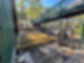
With week one completed, we all moved into our week two and three working rythyms. The women continued building the new queen beds for more of the conference center lodging venues while the men started construction of a new storage shed behind to the kitchen and dining facility. This was not some 'kit' but was constructed the old fashioned way, from the needed raw materials provided by the camp. The 12' by 18' shed would be constructed from the ground up between their covered refrigeration storage facility and the elevated walkway to the second floor dorm rooms above the dining hall of the Lee Building. The ground was prepared and 8 concrete footings were placed for the floor joists. The floor joists were covered with 5/8" treated plywood before we started laying out the walls. The sloped side wall common with the existing refrigeration units was constructed first. This was critical to getting the adjacent roof line lined up with the hole we created in the old wall which we removed next to the refrigeration storage area. This wall would also have the pedestrian door in it for access. The back wall was laid out on the shed floor prior to lifting it up and attaching it to the plywood floor and the adjacent wall. Construction on the shed got to the point where we had too many bodies so some of us were reassigned. While Karen and Janice were asked to paint the inside of the lifeguard storage shed, Paul and I were asked to cut/chisel out the edge of the concrete pool deck and add additional depth indicator tiles around the pool. This was one of those safety code compliance projects the staff was not comfortable doing but needed it to be done. It would require some finesse to cut down just enough of the pool deck concrete and square the corners. Paul did a marvelous job with the concrete saw and grinder while I cleaned up the rough cut space, added mortar to float the tiles even with the deck level and smoothed out the edges. Having never done anything like this in my life I was quite happy with the results. It came our great and the camp staff was thrilled. From there Paul and I moved over to the Chafin Lodge building to remove and replace two windows that were problematic. The old windows went down to the floor and apparently a camper fell through one of them and was injured. The staff wanted us to replace them with smaller windows above a wall we would construct. This is what we did until the end of the project. When we had some free time we used the camp's kayaks and paddle boats to explore the north end of Lake Livingston. We also enjoyed some dinners out with the team. The men working on the storage shed were able to complete the roof deck after installing these trusses. All in all, it was a very productive overall assignment. The camp director was extremely pleased with the quantity of work we were able to accomplish and the quality of our product. This was the first time an RVICS team has worked with this camp and I anticipate they will want us back in the future. Karen and I said our goodbyes to our fellow RVICS workers and departed the camp on Thursday, March 26th so we could return to the village in Smithville. We were expecting family to arrive on Saturday night and needed to get back earlier than usual.
- Trinity Pines Conference Center
After Camp Zephyr we returned to the RVICS Village on Friday, February 27 for an Italian potluck dinner. Karen and I had medical appointments for the coming week before our next project. On Wednesday, March 4th we drove up to a US Army Corps of Engineers Park outside of Waco, Texas for two nights. Karen was able to spend some time with her friend Lisa Stary who lives in Waco and also get a haircut. I spent my time working on a USCG Auxiliary specialist course in Marine Safety and Management. We were originally planning on heading north to the Dallas/Fort Worth area so I could attend the District Training Seminar for Risk Management/Team Coordination Training (RM/TCT) but alas the clowns in Congress haven't approved funding for DHS, so the entire event was cancelled. When Friday rolled around we headed for our next RVICS project at Trinity Pines Conference Center. Trinity Pines is a beautiful lakefront campus located just two hours north of Houston. Open year round, they welcome ministry groups of all sizes, from one to seven hundred. All nations and people groups are welcome and encouraged to experience the Christ-centered, spiritual setting of Trinity Pines. Their campus has a variety of lodging selections, conference rooms, delicious dining services, a wide array of recreation areas, and exceptional outdoor meeting locations with a high ropes course, lakefront activities, a pool, campfires, wagon rides, hiking trails, gaga ball, miniature golf, disc golf, volleyball courts, basketball courts, and more. We arrived on Friday, March 6 around 3:30 PM and found a nice back-in site surrounded by pines. We are in site #3 next to our team leaders, Scott and Shalon McCart who are in site #2 and Jim and Tamra Studioso in #4. We have a large team of six couples on the assignment that include the Kline's, Tony and Barbara, the Willis', Alan and Pat, and our previous team leaders the Hazelet's, Paul and Janice. On Sunday, March 8 the camp staff included us in a Crawfish Boil. We got to meet many of the permanent staff members and their families at this get-together. Our first day of work started on Monday, March 9 in the Brumley Motel, a two-story lodge with 27 rooms. Each room has 6 bed spaces with one queen bed and 2 sets of bunk beds. The women were assigned with the task of disassembling the older wooden queen beds and replacing them with new metal frame beds. This is what the room furnishings looked like prior to the remodeling with new beds. Karen and Tamra building a new queen bed in one of the Brumley rooms. Some of the men helped move the wooden beds out of the Brumley Motel and move the new metal beds close to the rooms for the women to complete the assembly. The other men began the process of removing and replacing the motel room front doors. We completed all 27 rooms by the end of Wednesday of the first week and went on to Chafin Lodge to replace more queen beds. The Chafin Lodge has long been one of the most requested lodges at Trinity Pines. Chafin has 11 private rooms and a full kitchen. Each room has 5 beds and 6 bed spaces with 1 queen bed and 2 sets of bunk beds. Chafin holds a maximum of 66 guests with a minimum of 35 guests to reserve. This where we finished out our first week of work in the camp. Friday was tour day and we all drove down to Huntsville to visit the Texas Prison Museum. The Texas Prison Museum offers an intriguing glimpse into the lives of the state's imprisoned citizens. The museum features numerous exhibits detailing the history of the Texas prison system, featuring a look inside the operations behind the fences and walls. Huntsville Prison (the "Walls Unit"), opened in 1849 as Texas's first state penitentiary, is primarily known as the most active execution chambers in the United States. Located in Huntsville, it houses the state's death row, was the former home of "Old Sparky" (the electric chair), and previously hosted the famous Prison Rodeo. After our tour we enjoyed lunch at the City Hall Cafe and Pie Bar. I had their Orange & Bleu burger. Sharp and salty aged bleu cheese and homemade jalapeno fig jam, oven baked bacon, pickled red onions, and lettuce. Karen selected the grilled shrimp and salad bar. Our server Anna was super attentive and I finished off lunch with a slice of vinegar pecan pie. I learned that most good pecan pie fillings, even without corn syrups or chemical thickeners has to be (and usually is) borderline disgustingly sweet. The vinegar helps cut the sweetness just a bit, and adds a tiny-bit of much needed acidity. It was delicious! Week one at Trinity Pines Conference Center completed. We are all enjoying this assignment and accomplishing more than the Camp Staff expected. 😃
- Camp Zephyr Project - Week 2 & 3
With the bunk beds built and ready for a couple of coats of polyurethane, the ladies took over. The men moved into the new Dimmick building under construction to start paneling out the four dormitory rooms for the campers. Two rooms for the girl campers and two rooms on the south side for the boys. We set up a large table at the end of the table saw to accommodate the cut sections of 4x8 T1-11. It also made a great platform for cutting out some of the switch and outlet holes with a router tool. A team of two positioned each sheet, checked with a level and then stapled. When we started, the rooms were framed out, wired, plumbed and insulated. Our job was to cover all the walls with T1-11 siding, cutting out the holes for the wiring and plumbing, then finish trimming out all the corners and ceiling. Stuart discovered years ago that to use T1-11 in the dorm rooms was the way to maximize durability over traditional gypsum board in these heavily used rooms. We discovered that working in teams of two or three to measure, cut, position and nail the panels to the framed walls was the most efficient method of tackling the project. We had two portable compressors available to power the staple guns used to attach the 1/4 inch T1-11. Holes were cut with either a battery powered router or oscillation saw that team members had with them in their RV's. In four days, we managed to use up the 200 sheets of T1-11 delivered to the camp and more had to be ordered. The large rooms were completed rather quickly, it was the smaller spaces like the shower rooms and bathrooms that slowed the process down with multiple smaller panels and odd cuts to accommodate shower inserts and plumbing. Once all the panels were cut and installed we finished off the walls with inch and a half strips of cut T1-11 trim at the ceiling edge, horizontal wall seams and exposed wall edges. Back in the gym the ladies were coating the wooden bunks with multiple layers of polyurethane to seal the wood. All the bunks had three coats by the end of the third week of the project. We completed our RVICS assignment at noon Thursday February 26 with only a couple of unfinished bathrooms, upper two foot panels and trim to finish. We would have completed the entire project had we not run out of materials. Ironically, more material arrived on a truck Thursday evening. On Friday morning as we were packing up our RV's to depart, we noticed the camp staff moving the new materials into the building to finish what we started. The 'Fab Four' of RVICS on the last day of the Zephyr Project.
- Camp Zephyr Project-Week One
The RVICS men started working on Monday, February 9th here at Zephyr on our first building project. The camp needed another 22 bunk beds constructed for their new dormitory. While we were cutting 2x6's and 2x4's, the women were tasked with inspecting all the cabins and hotel rooms to create a punch list of any and all needed repairs before the camping season began. They followed that assignment by sanding the 18 "well used" bunks beds in preparation for a new coat of polyurethane. Lumber was delivered to the camp gym and we began the process of cutting down the material to the component parts using a chop saw with a jig to keep the cuts consistent. Once all the bunk parts were cut we started systematically assembling one bunk bed at a time. We eventually got a routine going with Steve and John assembling all the bed components together while Tom and Paul did the router/sanding finishing work. Two of our ladies, Kathy and Karen, assisted us in painting the bottoms of the upper bunk bed panels. Stuart, the camp's retiring maintenance manager, came up with this brilliant solution to eliminate the writing that campers like to add to the bottom of the top bunk beds.. He's never had a camper come to camp with a while marker or pencil so they don't have to deal with inappropriate graffiti. By Thursday afternoon, February 12th, we had all 22 bunk beds completed and a mess to clean up in the gym. It's a blessing to work hard and serve the camp staff! But it wasn't all work and no play during the week. We play hard too! Monday night after dinner we played "Mölkky", had a campfire and made popcorn. Mölkky is a popular Finnish outdoor throwing game played by knocking over 12 numbered wooden pins (1–12) with a single throwing skittle to score exactly 50 points. It combines strategy and skill, as players must stand pins upright where they land after each throw, causing the playing area to spread. Paul is melting the butter for the popcorn he made over our campfire after Mölkky. Wednesday evening we were invited by the Camp Director Nathan and his wife Jade to join their family for dinner and a time of fellowship. We enjoyed a baked potato bar, home-made chili, salad and mac 'n' cheese with their four boys and one of the camp staffers. Dessert included an ice cream bar with all the fixings! Friday was a day to get out and explore the area so we all drove into Corpus Christi, about an hour away, to tour the U.S.S Lexington Museum. USS Lexington (CV/CVA/CVS/CVT/AVT-16) is an Essex-class aircraft carrier built during World War II for the United States Navy. Originally intended to be named Cabot, the new aircraft carrier was renamed while under construction to commemorate the recently lost USS Lexington (CV-2), becoming the sixth U.S. Navy ship to bear the name in honor of the Battle of Lexington. Lexington was commissioned in February 1943 and saw extensive service through the Pacific War. For much of her service, she acted as the flagship for Admiral Marc Mitscher, and led the Fast Carrier Task Force through their battles across the Pacific. She was the recipient of 11 battle stars and the Presidential Unit Citation. Sixteen decks. A length of three New York City blocks, a displacement of more than 33,000 tons, and a flight deck big enough to hold 1,000 cars. More sleeping space than the world’s biggest hotel and the ability to produce enough electricity to power a city of 150,000 people. All of this describes the USS Lexington. It was fascinating to visit this American legend on the Bay. Nicknamed the "Blue Ghost" by the Japanese after they discovered it was named after the prior Lexington (CV-2) that they sank at the Battle of the Coral Sea. We spent 6 hours and still didn't see everything. Our dinner destination after a long day of walking on the "Blue Ghost" was Snoopy's seafood restaurant on Padre Island to complete the evening.
- Heading South to the Texas Coast
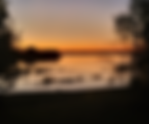
After returning from our trip to San Diego, California we packed up the RV for our first RVICS project of the new year. Departing Smithville on February 2nd we traveled south to spend three days at the Goose Island Texas State Park. Goose Island State Park (green dot), located on the Texas coast near Rockport on Aransas Bay, was established between 1931 and 1935 on land acquired from private owners and a state-owned island. Developed by the Civilian Conservation Corps (CCC) in the 1930s, the park is famous for the "Big Tree," a 1,000+ year-old coastal live oak, and serves as a key area for birding. Although it is located on the seashore, there is no designated swimming area at the park, as the shoreline consists of concrete, oyster shell, mudflat, and marsh grass. Instead, the main park activities include camping, birding, fishing, and boating. The park averages more than 60,000 overnight campers each year and has about 200,000 visitors annually. There are 45 shade shelters with electricity and water on the island. There are 57 shelters with electricity and water, and 27 with water and no electricity. A massive wooden wharf structure extends out over the water and is used for fishing the speckled trout, redfish, drum, flounder, and sheepshead common to the region. While in the area I had an opportunity to visit another Coast Guard Flotilla in our Division. Flotilla 07-09 was meeting at the Rockport Yacht Club on Tuesday, so I drove into town and attended their meeting and later joined them for pizza at a local establishment. Despite the windy conditions, we experienced some spectacular sunsets on the Texas coast. After two of the three days booked, we deciding to leave the afternoon of Wednesday, February 4th for our RVICS project at Zephyr Baptist Encampment near Sandia, Texas. Our RV area is next to the camp's ropes course and zip line down to the lake. Zephyr Baptist Encampment is a Christian Camp & Conference Center located in South Texas. It was founded in 1957 by a group of individuals and churches who had a passion for Christ and a desire to see Him work through camp ministry. The goal of Zephyr Baptist Encampment is to provide an environment that encourages development in spiritual, intellectual, emotional, social, and physical areas. Their constant desire is that each person who comes through the gates will feel the love of Christ through friendly service, well maintained facilities, quality meals and attention to detail. We arrived the same day as our team leaders Paul and Janice Hazelet from Gilette, Wyoming. By Friday, February 6th, the rest of our team arrived. Tom and Shelley Stafford from Hays, Kansas traveled from the RVICS Village in Smithville. Steve and Kathy Yoshimi are on their first RVICS project and come to us from Yucca Valley, California. Top row: Paul, John Tom and Steve and seated: Janice, Karen, Shelley and Kathy (front left to right) Monday, February 9th is the first work day at Zephyr and we are looking forward to all working together and accomplishing our mission and ministry to the camp and its staff.
- Where have we been?
Icicles formed down the front of our fifth wheel for three days. Recently we started getting emails from some of you inquiring about our blog status and asking if we are okay. Well, the truth be known, I have been lazy about posting. I'll get you all up to speed with this post and try to do a better job of keeping the blog updated. DECEMBER 2025 We spent almost all of the month in Smithville, Texas so Karen could recover from her hip surgery. We traveled into Bastrop at least twice a week for her physical therapy appointments. While in Bastrop we would do our grocery shopping at the super HEB or Walmart. Our social calendar included Dairy Queen and Thursday lunches out with the RVICS Village gang. We celebrated Christmas and New Years in the Village. It was a quiet and modest holiday season for us, compared to the rest of the year. I was able to accomplish getting my Basic Life Support (BLS) fundamentals completed during the month, so I'm First Aid, CPR and AED certified for another two years. During the month of January we experienced some sleet and freezing conditions that saw temperatures down in the twenties here in Smithville. JANUARY 2026 Our new year was expected to start off with a bang! We had a scuba diving trip planned for January 9th thru the 18th to the island of Guanaja in Honduras with our diving buddies who we traveled to Raja Ampat, Indonesia last year. We just had to get a clean bill of health from Karen's hip doctor clearing her for diving the Thursday prior to our departure. Well, Karen was given the A-OK to go but due to a TIA, I (John) ended up in the emergency room at the same Austin hospital where Karen had her surgery. "A Transient Ischemic Attack (TIA), or "mini-stroke," is a temporary blockage of blood flow to the brain causing sudden, stroke-like symptoms (weakness, numbness, speech trouble, vision loss) that usually lasts a few minutes to an hour, resolving within 24 hours . It is a critical warning sign for a potential major stroke, often occurring hours or days before hand. Emergency medical care should be sought immediately, as prompt treatment can prevent a future, permanent stroke. " In the 2 weeks prior, I had three vision incidents involving a temporary loss of my peripheral vision in my left eye. I was concerned it could be serious enough to be a problem while out of the country, so after Karen's check up we stopped at the VA Clinic in Austin. The medical staff checked me over and immediately sent me back to Del Seton Medical Center Emergency Room in Austin. I was admitted and spent the next two days, January 6th to the 8th being evaluated. My care in the hospital was thorough and outstanding, but unfortunately our scuba diving trip had to be cancelled. Day two-catching up on my sleep after all my labs After two MRI's, one CAT Scan and Echocardiography the Neurologist determined I had a minor narrowing of a blood vessel on the right side in the rear of my brain that most likely was the issue causing the vision problem. The solution was to prescribe a statin drug, baby aspirin and 90 days of a blood thinning drug to mitigate the symptoms. No scuba diving for a month. Fortunately, we had trip insurance with the Diver's Alert Network (DAN) to cover our diving trip cancellation, but we were bummed to miss hanging with our Dive Buddies. Upon release from the hospital, that evening I attended my new Coast Guard Flotilla meeting before returning to the Village with Karen. I had no more peripheral vision problems and was feeling fine. The next week, on Friday, January 16, I had a scheduled VA lab appointment prior to my annual physical seven days later. I had recently moved my VA health care to the Austin VA Medical Center and was meeting my new primary provider for the first time. After our meeting I was able to schedule all my follow-up meetings with a VA Neurologist, Audiologist, Ophthalmologist and G astroenterologist at that new facility. It is conveniently located near the Austin-Bergstrom International Airport just 40 minutes from the Village. With all the medical stuff out of the way, we made plans to attend Bob and Gail Conrad's 50th Wedding Anniversary party on January 30th in San Diego, California. Karen and I flew out a couple of days early to spend some time visiting these good friends before the big event. Bob and I have known each other since the fifth grade, we were photography business partners for 8 plus years and he was my best man when Karen and I got married. I have been close to both of them for over 55 years! We had a great time in San Diego seeing Bob and Gail's siblings, relatives, children and grandchildren sharing stories and honoring their special day. Their kids, Jenny and Robbie, put together a great event for them and we were happy to be a part of this special day.
- Karen has her New Hip
Well Monday, November 24 started early with Karen getting up at 2:30 AM to take her "special" shower before her hip surgery. I was out of bed by 3:00 AM and we were on the road for Dell Seton Medical Center at The University of Texas, Austin by 3:30 AM. Her check in time was 4:45 AM and we arrived early after parking the truck in the garage structure. Following the check-in process we were escorted to a pre-op room were she changed and began the lengthy pre-op procedures. By 7:00 AM they rolled her out to surgery and I retreated to the cafeteria to get some breakfast and later the truck to try and sleep. Karen was fortunate to find Dr. Koenig here in Texas. Dr. Koenig is an associate professor and serves as both the Division Chief of Orthopedics and the Director of the the Joseph Miles Abell Jr., M.D., Clinical Fellowship in Orthopaedic Surgery for the Dell Medical School Department of Surgery and Perioperative Care at The University of Texas at Austin. Dr. Koenig earned his medical degree from Baylor College of Medicine and his master’s in clinical sciences from Dartmouth Institute for Health Policy and Clinical Practice, where he began his work on patient outcomes and cost-effectiveness research. He completed a residency in orthopedic surgery at Dartmouth-Hitchcock Medical Center and a fellowship in adult reconstruction at Stanford University Medical Center. While at Dartmouth, Dr. Koenig was one of the architects of GreenCare Pathways, a quality improvement initiative around total joint replacement, and led the Division of Adult Reconstruction at Dartmouth-Hitchcock Medical Center. I would periodically receive text messages on her status and by 10 AM I got the call from her surgeon Dr. Karl Koenig that she was in recovery, everything went as planned and that I could she her in about an hour after the anesthesia wore off. By 11:00 AM we were together again in a post-op room. She met with Dr. Koenig, recovery nurses and a physical therapist prior to being discharged at 3:30 PM. They wheeled her out to the covered parking garage and we loaded up using a portable step up to the passenger side of the truck. She had done this before two years ago so she knew the process. I think the physical therapist that escorted her out of the hospital was impressed with her technique based on his reaction to her method getting into the truck. We drove back to Smithville and arrived just after 5:00 PM. Karen used the walker to get to the trailer's steps and slowly walked up under her own power into the RV. It is nothing short of amazing that less than 8 hours earlier she was in surgery having her left hip replaced and now she was walking on that new joint! Now the real work begins. Her first week of rehab involves pain management and actively building up strength in the new hip. On Friday, November 28, the day after Thanksgiving, she has her first PT appointment in Bastrop. She has been walking around the RV using only a cane. Navigating is helpful having so many places to hold on to while she walks around the kitchen island or into the bathroom. Since her surgery, folks in the village have come by with meals, well wishes and are encouraging us with their thoughts and prayers. Karen's biggest need is someone to put on her shoes and socks. She ended up with a head cold upon her return home and is dealing with a cough and congestion, so she could use your prayers for healing in that area too. Today is Thanksgiving Day and we attended the RVICS village celebration with all our "Village People". We enjoyed good food and company together.
- Back in Texas
Once again home at the RVICS Village in Smithville we settled in unpacking and loading up the laundry baskets. We have spent the past week reliving some wonderful memories of our time away. Getting back to a regular routine has been an adjustment since returning from our whirlwind journey. Here are some of the closing highlights; Our last Saturday night aboard was spent at dinner with our shipmates: Skip and Karen from Nebraska and John and Sandy from Connecticut. We really enjoyed sharing many of our evening meals with their company. We hope to maybe visit them as we travel the country in our RV or perhaps see them on another cruise in the future. The Sun Princess docked in Fort Lauderdale, Florida on Sunday, November 15 at 6:30 AM. We had packed our suitcases the night before so we were ready to leave the ship after taking our showers and dressing. Earlier in the week Karen had booked bus transfer tickets from the port to the airport. Leaving the ship went quickly and once we cleared Customs and Immigration we boarded the bus for the short ride to Fort Lauderdale Airport. We ended up arriving almost 4 hours early for our flight. With the recently ended government shutdown and the possibility of flight cancellations or delays we wanted to make sure we had plenty of time to mitigate any complications. Because we were prepared for such issues, nothing came up to delay our return to Texas. Our flight was 2 hours and 40 minutes long and our neighbor Jon Ray picked us up at the Austin Airport shortly after our arrival. Since returning to Smithville we have had some appointments. Karen had a pre-op surgery appointment on Monday, November 17 in Round Rock just north of Austin that she needed to attend prior to her scheduled left hip replacement surgery on Monday, November 24. Yes, she is getting the other hip done this year, so we will be staying in Texas for the holidays. After seven weeks of rehab and physical therapy she should be back to normal. Karen is motivated to get back on her feet by January so we can do a scheduled scuba diving trip to Honduras. We appreciate all your good thoughts and prayers during the coming weeks. Our village friends will be around to help us if we need anything; it's a blessing they will bring us meals the first week! We will keep you all up to date as her healing progress moves forward.
- A Remarkable Life
I don't know how often you reflect on life. I find myself doing it more often now that I'm older and retired from my professional life. It has always been a part of my adult spiritual life to be thankful for the many blessings God has given me. I'm thankful for my faith in Christ and salvation, my wife and her unconditional commitment to me, my children and grandchildren. Thankful for my friends, some whom I've had since childhood. All of these things would certainly make anyone's life rewarding and full, but I'm feeling exceptionally blessed; blessed literally beyond measure. As we have traveled these past three and a half years, but especially these last five weeks, I've been struck by the age in human history I'm living in. What an amazing time to be alive and have all the resources I have. It's a blessing to be able to travel to far off places around this world with such ease and luxury; a privilege most other generations have never had available on this scale. In the last few weeks, I've seen ancient cities with their monuments, libraries, temples and theaters that were the wonders of the world in their time. But these cultures were lucky if they had working plumbing, drinkable water and a reliable source of food. They generally never traveled far from their city, state or region and had to worry about foreign conquesting armies throughout their history. The reality that this is the norm for most people in my generation is sobering at best. To see so many people with the resources and means on this ship living this way is humbling. To realize how so many more people in the world will never experience this much luxury and privilege makes me ask the question, "Why me Lord?" As I reflect on this simple question, the answer frankly is profound. We do nothing to deserve the family we are born into, the age in human history or place on the planet we are. I'm left with the only reasonable answer that I believe to be appropriate; "There by the Grace of God go I!" grace | ɡrās | noun 3 (in Christian belief) the free and unmerited favor of God, as manifested in the salvation of sinners and the bestowal of blessings. • a divinely given talent or blessing: the graces of the Holy Spirit. This perspective and belief is the operational foundation of my life, worldview and motivation in every human encounter. Our journey in life is just another opportunity to express God's unconditional love. As I encounter each server, I am poked with conviction and reminded of the need to continually be thankful for their presence and hard work. This ship has workers from all over the world and it has been a joy to get to know some of them, hear their stories and bless them with words of thankfulness and encouragement. I am compelled to make each one of them serving me feel valued and honored. . As Karen and I spend our retirement years traveling and enjoying this lifestyle, we are reminded to always look for opportunities to love and value everyone we meet and use our privilege to bless them. The cruise ship companies have a gratuity system in place to take care of all the principals like our cabin steward, dining room waiters and food prep staff. But everyone on this ship has made our time onboard an incredible pleasure. We are making an effort to remember others we have met so we can note them in our cruise review. This was our organic Bible study group onboard. Princess is the only cruise company that provides a venue to gather and we truly appreciate the time to study God's word together with brothers and sisters in the family of God. Karen and I are so very thankful for the past five weeks and the wonderful journey to see new places and meet new people created in the image of God!
- The Atlantic Crossing
We departed on the evening of November 4 traveling through the Straits of Gilbraltar from the Mediterranean Sea into the Atlantic Ocean. In the passage we could see the lights of Moracco in Africa. The Strait of Gibraltar, also known as the Straits of Gibraltar, is a narrow strait that connects the Atlantic Ocean to the Mediterranean Sea and separates Europe from Africa. The two continents are separated by 7.7 nautical miles ( 8.9 miles) at its narrowest point. The strait lies in the territorial waters of Morocco, Spain, and the British overseas territory of Gibraltar. Under the United Nations Convention on the Law of the Sea, foreign vessels and aircraft have the freedom of navigation and overflight to cross the strait of Gibraltar in case of continuous transit. Our next port of call on the itinerary was Cádiz an ancient port city in the Andalucia region of southwestern Spain. The home of the Spanish Navy, the port boomed in the 16th-century as a base for exploration and trade. It has more than 100 watchtowers, including the iconic Torre Tavira, which was traditionally used for spotting ships. On the waterfront is the domed, 18th-century Cádiz Cathedral, featuring baroque and neoclassical elements. Cadiz is famous for being one of the oldest continuously inhabited cities in Western Europe, founded by the Phoenicians around 1100 BC. It is also celebrated for its annual Carnival, which is one of the most famous and long-running in Spain. Additionally, the city is known for its historical importance as a major port for Spanish trade with the Americas, its beautiful golden-domed cathedral, its unique setting surrounded by the sea, and its role as a filming location famously appearing in the James Bond movie Die Another Day. When we arrived on the morning of November 5 at 7 AM we had pre-booked our Hop ON Hop OFF bus tickets for Cádiz. The city is full of fascinating places so wherever you hop off and explore, you’re sure to see something amazing. Puertas de la Tierra are part of the old city walls and today mark the boundary between the city’s historic center and its more modern neighborhoods. "Puertas de la Tierra" translates to "Land Gate" or "Gates of the Earth" in English and refers to the monumental, 18th-century gateway in Cádiz, Spain. It was once part of the city's defensive walls and now serves as a symbol of the city, separating the old and new parts of the city. We took a break from the bus and hopped off at the golden-domed cathedral to see it up close and enjoy the energy of the crowd. The Cathedral of the Holy Cross over the Waters (Spanish: Catedral de Santa Cruz sobre las Aguas) is a Catholic cathedral in Cádiz, southern Spain, and the seat of the Diocese of Cadiz y Ceuta. The church was known as "The Cathedral of The Americas" because it was built with money from the trade between Spain and America. The 18th century was a golden age for Cádiz, and the other cathedral in the city called Santa Cruz was very small for this new age in the history of Cádiz. The new cathedral was built from 1722 to 1838. From Cádiz we departed for Santa Cruz de Tenerife (Canary Islands) with a scheduled arrival on Nov 7 at 9 AM. By the end of the day on Wednesday, I was beginning to feel a bit under the weather with a scratchy throat and some congestion. Not to be expected in a crowded environment like a cruise ship. To be pro-active I started drinking more water and limiting my exposure to crowds. After a second sea day my symptoms continued to worsen so I made an appointment to get checked out at the ship's medical center. I had my vitals checked and it was determined to be a head cold and not the flu or something more nefarious. I planned on staying ashore while we docked in the Canary Islands; a bummer but the right call. We had originally made a reservation to do a scuba diving excursion here. That was canceled and Karen ran into town instead to get some decongestant and cough drops to help me mend. Fortunately, we have eight sea days as we cross the Atlantic Ocean. Crossing the Atlantic by cruise ship involves a significant amount of time at sea, usually six to eight days, with a focus on relaxation and onboard activities rather than daily port visits. Passengers can fill their time with the ship's amenities, such as dining, entertainment, and leisure activities, or use the time to unplug and relax. The experience is a unique and relaxing way to travel that can include the romance of ocean liner tradition, stunning ocean views, and opportunities to connect with fellow passengers. Here are some of the activities and entertainment we've enjoyed: 1) Relax and unwind: Enjoy the freedom from port-day pressure, which allows for sleeping in, reading, and enjoying ocean views. 2) Onboard entertainment: Participate in various activities like live shows, concerts, dance classes, trivia, and movies. 3) Explore the ship: Use the time to discover all the ship has to offer, from pools and hot tubs to casinos and lounges. 4) Learn a new skill: Some cruises offer classes in areas like art or other hobbies. 5) Relax by the water: Spend time at pools, hot tubs, and lounge chairs, with some ships having adults-only areas for extra tranquility. Our onboard social connections: Connect with others: With more time at sea, you can develop relationships with fellow passengers and crew members, leading to a more social experience. We've participated in a daily Bible study while on the ship. Also, we have been seated with 2 other delightful couples in the dining room for dinner each night. We have enjoyed their company at our window table with an amazing view. Network and share stories: Meet other well-traveled individuals who are often enthusiastic about sharing travel tips and stories. We learned about the veterans ship board credit of $250 from one of our fellow travelers. Experience classic ocean liner tradition: For many, the voyage is about appreciating the history and romance of ocean travel. Sitting and taking in the sheer magnificance of the Atlantic from our balcony is beyond words and such a gift! Potential downsides and our experiences: Rough seas: The Atlantic Ocean can have rougher waters than other cruising destinations, particularly the North Atlantic in cooler months. Modern ships, especially those like the Sun Princess, are designed to handle these conditions with stabilizing wings, but it can still be an uncomfortable experience for some. We have not had a single day of bad weather on this crossing; what a blessing! Boredom: A long period at sea may become boring for those who prefer a more active vacation, although the amount of time needed for this varies from person to person. We have not experienced any boredom...none! Internet issues: Internet access is often slow and expensive, making a transatlantic cruise a good opportunity to disconnect. Our internet has been flawless, hence I've been able to post on our Blog. We are on day 6 of the crossing with two remaining days until we reach Fort Lauderdale. I can truly say the experience has been wonderful and would entertain doing it again in the future. November is a great time to make the trip and there are many options with other cruise ship companies from different departure ports in Europe.